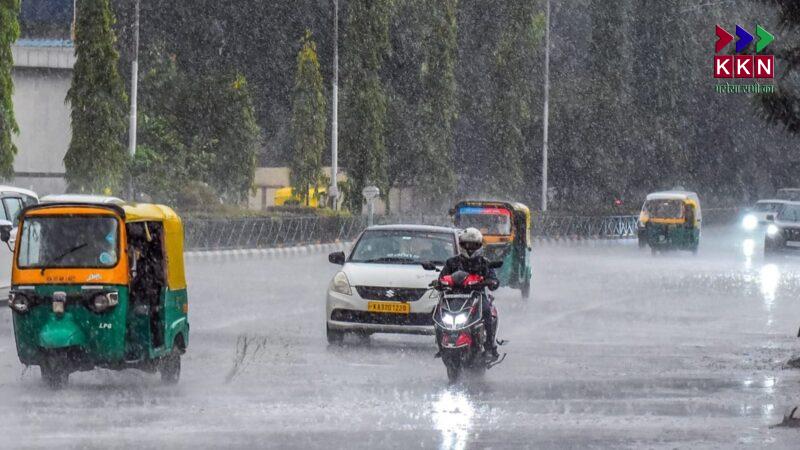
KKN Gurugram Desk | A fresh spell of moderate to heavy rainfall is expected to sweep across North India starting April 16, 2025, as a new Western Disturbance becomes active over the Western Himalayan region. The India Meteorological Department (IMD) has issued alerts for several states, forecasting rain, thunderstorms, gusty winds, and even snowfall in some areas.
Article Contents
According to weather experts, including a recent Skymet Weather report, this disturbance could lead to significant weather activity between April 16 and April 20, particularly affecting Jammu & Kashmir, Himachal Pradesh, Uttarakhand, and parts of Ladakh.
Western Disturbance to Impact Weather Across the Himalayas
What is a Western Disturbance?
Western Disturbances are extra-tropical storms originating in the Mediterranean region that move towards India, especially during winter and spring months. These systems are known for bringing unseasonal rain, snow, and temperature drops to northern India.
Active System from April 16
The upcoming Western Disturbance, expected to begin influencing the region from April 16, will likely have widespread effects over the Western Himalayan states. Experts believe this system is stronger than the previous one that recently impacted northern India.
Keywords: Western Disturbance, heavy rain in North India, IMD alert, weather forecast April 2025, rain in Jammu & Kashmir
Weather Forecast Timeline: April 16 to April 21
April 16–17: Initial Signs
-
Light to moderate rain may start in isolated parts of Jammu & Kashmir on April 16.
-
Cloud cover and slight temperature dips expected across the northern plains.
April 18–20: Peak Activity
-
April 18 to April 20 is projected to see intense weather activity.
-
Heavy rainfall, thunderstorms, lightning, and gusty winds between 40–60 km/h could affect many parts.
-
Himachal Pradesh and Uttarakhand may witness hailstorms and moderate snowfall in higher altitudes.
-
April 19 is forecasted to be the most active day with the highest intensity of rain and storm.
April 21: Gradual Clearing
-
The system will begin to weaken from April 21 onward.
-
Residual showers and cloudiness may persist in some areas before clear skies return.
Keywords: thunderstorm alert North India, IMD rain forecast, April 2025 Western Disturbance
States to Be Most Affected
1. Jammu & Kashmir
-
Heavy rain and snowfall likely in higher reaches.
-
Risk of landslides, slippery roads, and rockfall in mountainous areas.
-
Tourist regions like Gulmarg, Pahalgam, and Sonmarg may face temporary travel disruptions.
2. Himachal Pradesh
-
Moderate to heavy rain and snow forecast, particularly in Shimla, Kullu, Manali, and Lahaul-Spiti.
-
Possible roadblocks and low visibility in hill passes.
-
Residents advised to avoid non-essential travel in high-risk zones.
3. Uttarakhand
-
Light to moderate rain with isolated thunderstorms expected.
-
Hilly districts such as Chamoli, Rudraprayag, and Pithoragarh may see brief snow or sleet.
-
Local administration may issue advisories for trekking and pilgrimage routes.
Keywords: rain in Uttarakhand, snowfall in Himachal, Jammu Kashmir weather alert, North India storm April 2025
Other Regions Affected
Delhi-NCR, Uttar Pradesh, and Rajasthan
-
These plains states may experience minimal impact, limited to brief showers or overcast skies.
-
Western Rajasthan might observe dust storms in some districts due to changing wind patterns.
-
Delhi-NCR could see a temporary dip in temperature and short spells of rain, mostly during the evening or night hours.
Ladakh
-
Leh and surrounding regions may receive snowfall on April 18 and 19.
-
Road connectivity between Leh and Srinagar might be affected due to icy conditions.
Potential Hazards and Travel Advisory
Due to the intensity of the system, the IMD and local administrations have issued the following warnings and recommendations:
-
Avoid travel in hilly terrains between April 18–20 unless absolutely necessary.
-
Possibility of landslides, road blockages, and flash floods in vulnerable regions.
-
Farmers are advised to delay harvesting and cover ripened crops where possible.
-
Tourists should check weather advisories before visiting hill stations or high-altitude passes.
Why This Weather System Matters
Unseasonal Rains Disrupt Normalcy
This is the second major Western Disturbance this month, which has raised concerns about unseasonal rain damaging standing crops, particularly wheat and fruits in North India. These disturbances, though natural, have begun to appear more frequently due to climate pattern shifts.
Impact on Agriculture
-
Wheat, barley, and fruit orchards in Punjab, Haryana, Himachal Pradesh, and Uttarakhand are vulnerable.
-
Storms or hail could damage crops nearing harvest, affecting both yield and quality.
Keywords: crop damage by rain, unseasonal rain North India, agriculture impact Western Disturbance
Climatic Trends and Changing Weather Patterns
Weather experts suggest the increasing frequency of Western Disturbances and erratic rainfall patterns are tied to global climate change. Warmer ocean temperatures, jet stream fluctuations, and El Niño/La Niña phenomena can all contribute to these shifts.
Need for Better Preparedness
-
Investment in early warning systems and disaster preparedness at the local level is essential.
-
Stronger communication between IMD, state agencies, and the public can minimize damage and loss of life.
The upcoming Western Disturbance from April 16 to April 20 is expected to bring significant weather activity to the northern parts of India. Residents in Jammu & Kashmir, Himachal Pradesh, and Uttarakhand should stay alert and follow all official advisories.


